


RIPLEY, Montgomery County, Indiana
About
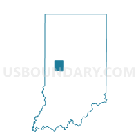
Outline

Summary
| Unique Area Identifier | 579832 |
| Name | RIPLEY |
| County | Montgomery County |
| State | Indiana |
| Area (square miles) | 31.61 |
| Land Area (square miles) | 31.58 |
| Water Area (square miles) | 0.03 |
| % of Land Area | 99.91 |
| % of Water Area | 0.09 |
| Latitude of the Internal Point | 40.00393610 |
| Longtitude of the Internal Point | -87.04779180 |
Maps


Graphs
Select a template below for downloading or customizing gragh for RIPLEY, Montgomery County, Indiana


Neighbors
Neighoring Voting District (by Name) Neighboring Voting District on the Map
- BROWN, Montgomery County, IN
- HOWARD, Parke County, IN
- JACKSON, Fountain County, IN
- UNION 01, Montgomery County, IN
- UNION 06, Montgomery County, IN
- UNION 07, Montgomery County, IN
- WAYNE, Montgomery County, IN
Top 10 Neighboring County Subdivision (by Population) Neighboring County Subdivision on the Map
- Union township, Montgomery County, IN (24,587)
- Brown township, Montgomery County, IN (1,719)
- Wayne township, Montgomery County, IN (1,590)
- Ripley township, Montgomery County, IN (977)
- Jackson township, Fountain County, IN (628)
- Howard township, Parke County, IN (341)
Top 10 Neighboring Place (by Population) Neighboring Place on the Map
Top 10 Neighboring Unified School District (by Population) Neighboring Unified School District on the Map
- Crawfordsville Community Schools, IN (15,558)
- North Montgomery Community School Corporation, IN (11,993)
- South Montgomery Community School Corporation, IN (10,573)
- Southeast Fountain School Corporation, IN (7,098)
- Turkey Run Community School Corporation, IN (3,937)
Top 10 Neighboring State Legislative District Lower Chamber (by Population) Neighboring State Legislative District Lower Chamber on the Map
- State House District 28, IN (69,656)
- State House District 41, IN (68,641)
- State House District 42, IN (58,863)
Top 10 Neighboring State Legislative District Upper Chamber (by Population) Neighboring State Legislative District Upper Chamber on the Map
Top 10 Neighboring 111th Congressional District (by Population) Neighboring 111th Congressional District on the Map
Top 10 Neighboring Census Tract (by Population) Neighboring Census Tract on the Map
- Census Tract 9569, Montgomery County, IN (5,403)
- Census Tract 9579, Fountain County, IN (4,431)
- Census Tract 9573, Montgomery County, IN (4,138)
- Census Tract 301, Parke County, IN (3,946)
- Census Tract 9580, Fountain County, IN (3,522)
Top 10 Neighboring 5-Digit ZIP Code Tabulation Area (by Population) Neighboring 5-Digit ZIP Code Tabulation Area on the Map
- 47933, IN (27,937)
- 47952, IN (2,798)
- 47990, IN (1,627)
- 47949, IN (1,332)
- 47989, IN (1,281)
- 47859, IN (1,066)
- 47916, IN (64)